The two things which have stuck in my mind most since last week’s Permaculture class are: water levelling, and the role of “apertures” in landscape formation.
Sounds heavy, eh! And indeed, gravity does have a role to play in both!
Our practical exercise of the day was A Beginner’s Guide to Surveying. You’ve all seen those TAFE students out in the park with their Hi-Viz vests holding those funny looking devices on tripods? Yep, we got to play with that stuff! (but not the vests).
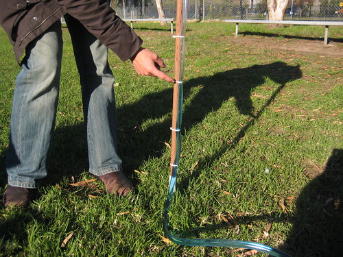
It was quite fun. There were laser levels, telescopic levels, and – my favourite – water levels.
The water levels (among the most ancient and low-tech of the levelling family) are based on the extraordinary (but perfectly logical) idea that water in a closed system always reaches a level. So if you have a long see-through hose filled with water, you can stretch it out as far as you like, and the top level of the water at both ends will be the same.
The same holds for a hose which is connected to a large water container – as in the demonstration Nick provided in class. He even coloured the water with blue dye to dramatise the effect. Here’s a few more photos of the process.
The main “learning outcome” from all of this watery-levelly business is that no matter how flat a piece of land might look and feel, it’s almost guaranteed that it slopes in one way or another! This comes as quite a surprise: the raw feel and instinct of experience versus the empirical evidence of measurement.
If you’re not careful with your existential stability, it can quite powerfully throw into question the relative up-ness and down-ness of our occupation of the planet. Take for example, this amazing sci-fi picture of a space station Torus thingummy. How would a water level operate, if its length was a significant proportion of this Torus’ curve?
Come to think of it, the Earth is curved! So how can anything be “level” (except relative to the human scale?)